 |
| Look how close we are to Canada |
This post is kinda long - sorry, I know that I really need to do them a little more often so you don't have so much to read. Marty has taken lots of photos so you can just look at those if you don't feel like reading.
We arrived at our summer destination of Forks, Washington on Wednesday, April 29th. Forks is on the west side of the Olympic Peninsula about an hour away from the northwestern most point of the mainland United States (Cape Flattery) and about 3 1/2 hours from Seattle. Our job for the summer is volunteering at the Forks Timber Museum and by the end of the summer we should be able to answer any questions you may have about logging (at the very least we'll make up something believable for all you city slickers).
 |
| Our home for the summer, see Bella's red pickup truck in the background |
Once we were settled in, the museum manager Linda and her husband (and volunteer coordinator) Joe invited us to their home for dinner and to go over our duties. We are the first work-campers they've used here and we will work a total of 28 hours a week, Saturday thru Tuesday. We will have a week off every month so there will be lots of time for exploring. On Thursday morning Joe and Linda picked us up and gave us a quick tour of Forks. All the important sites were covered - the post office, the library, the hospital and, for you Twilight fans, the Cullen house. The Twilight book series was set in Forks and it's still very popular with tourists. We even have Bella Swan's red pickup truck parked in our parking lot which we share with the Visitor's Center next door. There is a nonstop flow of people taking pictures with Bella's truck - I'm amazed at how popular Twilight still is.
On Friday we were given an orientation by a fellow volunteer and long-time resident of Forks, Tom. He explained each exhibit and then showed us a video of when the museum was built. It was built by the Forks High School carpentry class in 1989-90. They did everything except the mechanical systems. From the look of the building I'm sure they all got A's.
We were both trained so either one us of can work any of our days. So far, we've worked together because the museum has great wi-fi and even though our rig is parked right behind the museum our wi-fi in the rig has been very spotty. While we are in the museum we have full access to their computer and wi-fi so we are both very happy to be inside the museum. We started working by ourselves on Saturday, May 2nd and had a total of 13 visitors in our six hours there. Our next three days weren't much busier, on Monday we only had three people. It's slow because we aren't quite into tourist season yet, things should pick up after Memorial Day. Linda has a lot of projects she'd like to get done and we're hoping to help with some of those, that will make our days go faster.
When we applied for this job and talked to Joe and then later to Linda they both emphasized how rainy and gray this part of Washington is. They wanted to make sure we'd be ok with that since we were committing to be here until September. Forks, Washington has an average rainfall of 119 inches a year! We've been here almost a month and it's only rained hard two evenings and a little bit one afternoon. Most of the time it's grey but we have had some beautiful blue sky days too. The temps are mostly in the 60's so as far as I'm concerned it's pretty much perfect and only going to get better as we head into summer.
It looks like we really lucked out coming up here, there is a lot of stuff to do in the area, our job is interesting, the weather has been good and we couldn't ask for better bosses.
EXPLORING
The closest big towns to Forks are Port Angeles (about 60 miles) and Sequim (about 75 miles northeast of us. If you look at the map you can see that one way to go is to take 112 along the Straits of Juan de Fuca, a beautiful drive. We did take this route and my phone beeped with a new message -
We are only about 15 mile east of LaPush (home of Jacob Black) which is right on the Pacific Ocean. There are three beaches there; First Beach, Second Beach and Third Beach (such imaginative names). We have visited First and Second Beach and hope to visit Third Beach soon.
 |
| Oh, no! I left my passport at home! |
We are only about 15 mile east of LaPush (home of Jacob Black) which is right on the Pacific Ocean. There are three beaches there; First Beach, Second Beach and Third Beach (such imaginative names). We have visited First and Second Beach and hope to visit Third Beach soon.
 |
| First Beach at low tide |
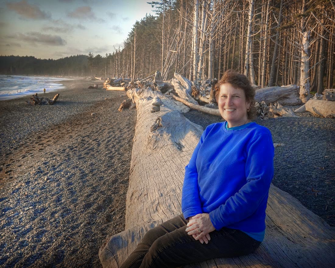 |
| Second Beach - the hiking/climbing over logs was worth it! |
 |  | |||||||
| More pictures of Second Beach - Anemone we spotted in a tidal pool at low tide |
 |
| We also visited a very rocky beach in Clallam Bay hoping to see whales. |
 |
| These trees are amazing! |
 |
| We saw this deer a few times while we were hiking |
As we were driving along 101 we saw a sign that said "Big Red Cedar" so we decided to check it out. We turned down the road and about 1/4 mile later we were there and it was a big red cedar which used to be even bigger.
 |
| This tree is massive and fun to explore |
 |
| Looking inside the trunk of the Big Red Cedar |

Further down the road there was another sign that said "Big Red Cedar" so, once again, we decided to check it out. This road was quite an adventure - we drove about four miles with the road becoming gravel with lots of potholes and getting narrower and narrower. It was a logging road and it's hard to imagine the big logging trucks maneuvering on it. Once we finally got there we walked the overgrown boardwalk trail around the 19.4' diameter of the tree.
 |
| Our 2nd Big Red Cedar Tree - The Duncan Memorial Tree |
One Friday (5/8) we visited Cape Flattery the northwestern most point of the mainland United States. It's about an hour to an hour and half drive northwest of us and we also stopped at the Makah Museum in nearby Neah Bay. The museum was pretty interesting, here's some information on what's there:
In the winter of 1969-1970 a storm caused the bank at the Ozette
village location to slump, exposing hundreds of perfectly preserved
wooden artifacts! A hiker contacted the Makah Tribe, then the Tribe
phoned Washington State University, and in April 1970, some two months
after the storm, excavation of the Ozette Archaeological Site began.
Makah oral history told of a “great slide” which buried a portion of
Ozette long ago. Archaeologists collaboration with the Tribe proved this
oral history correct. Radiocarbon dates demonstrated that a slide some
500 ± 50 years BP (before present) buried six longhouses and their
respective contents, locking the pre-contact wooden and wood-based
artifacts in a shroud of mud. The 11-year excavation produced over
55,000 artifacts, which the Tribe kept on the reservation. Consequently,
the MCRC came about from the Tribe’s desire to curate and interpret
this unique collection.
The hike to Cape Flattery was about one half mile; much of the hike was on boardwalks because of the marshy ground. The beginning of the trail was downhill which is never a good thing - what goes down must come up! It really wasn't too bad and well worth it - if you're in this area you have to come here just to be able to say you've been to the northwestern most point of the U.S.
 |
| The northwestern most point of the United States!! |
 |
| The view of Tatoosh Island from Cape Flattery |
One night on our way to dinner with Joe and Linda they showed us a waterfall right off the road that we would never have noticed - Beaver Falls. We drove back a few days later for some pictures.
 |
| Beaver Falls, one of many waterfalls in the Olympic Peninsula |
 |
| This tree isn't pregnant just "burl"y (sorry, I couldn't resist) |
 |
| Here's an example of a type of burl use |
That's it for this post, we are off work until next Saturday (5/30) so it's time to do some more exploring - life is good!


